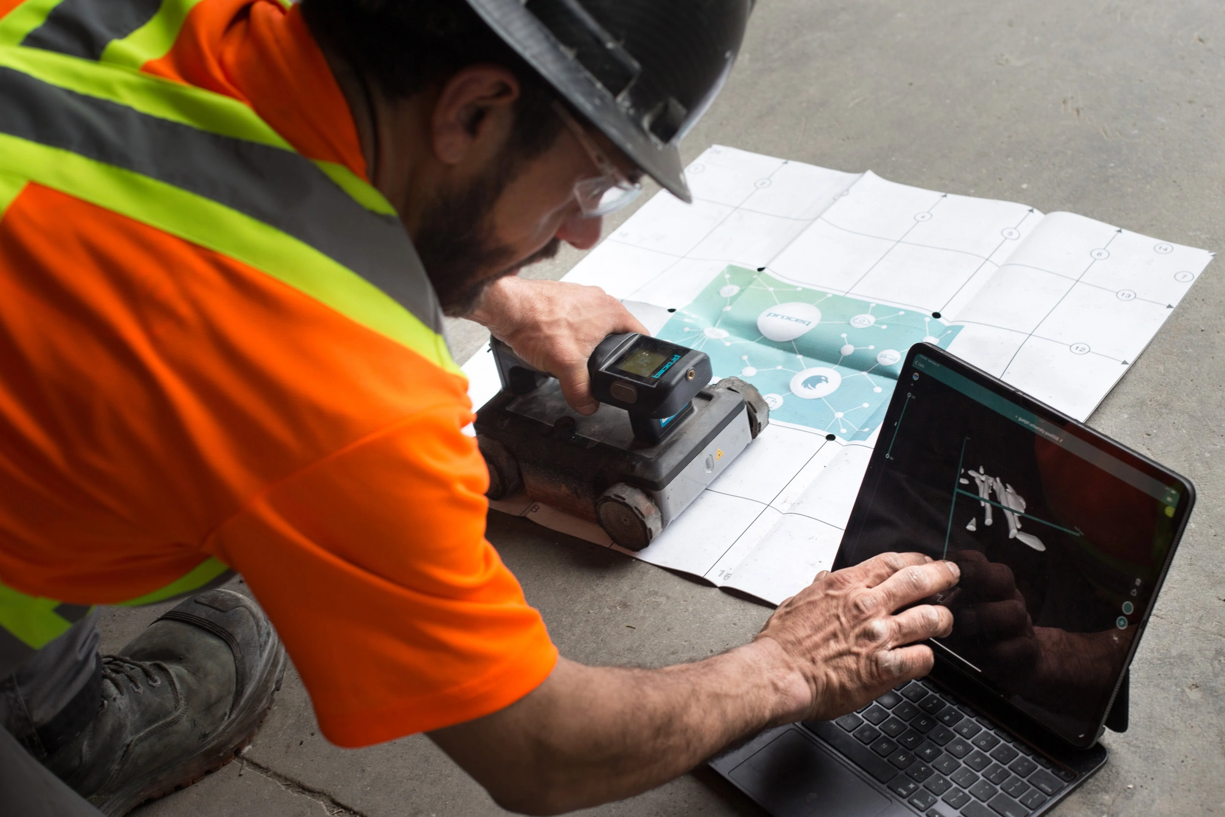
Ground-penetrating radar (GPR) turns a concrete slab into a readable map. Before a core drill or saw cuts through a structural floor, CDS can show you where the rebar, post-tension cables, embedded conduit, and buried services run — and where they do not. The job that would have crashed a PT strand becomes routine. The job that would have drilled through a live circuit becomes safe.
CDS has offered GPR concrete scanning since the technology became commercially reliable, and our operators hold current certifications on the equipment they run.
What GPR Scanning Finds
- Rebar and wire mesh — depth, spacing, and orientation
- Post-tension (PT) cables — critical before any penetration on elevated decks
- Conduit and plumbing — electrical, data, and pressurized or drain lines
- Voids and delaminations — early signs of failing slabs and bridge decks
- Slab thickness — including changes across a floor’s history of slab replacements
- Utility lines under soil — sewer, gas, fibre, and water before excavation
For a deeper look at subsurface imaging standards, see the ASTM standards library (D6432 covers GPR use in subsurface investigations).
When to Scan
Any penetration on a post-tensioned slab must be scanned. Most engineers, insurers, and facility managers now require GPR scans before coring, saw cutting, or anchoring on:
- Elevated slabs and parking structure decks
- Hospital, lab, and data centre floors (live services below)
- Bridge decks and abutments
- Any concrete older than 20 years where record drawings are incomplete
Our GPR Workflow
1. Site assessment
We confirm slab access, confirm it is dry (wet surfaces attenuate the signal), and grid off the scan area.
2. Two-pass scan
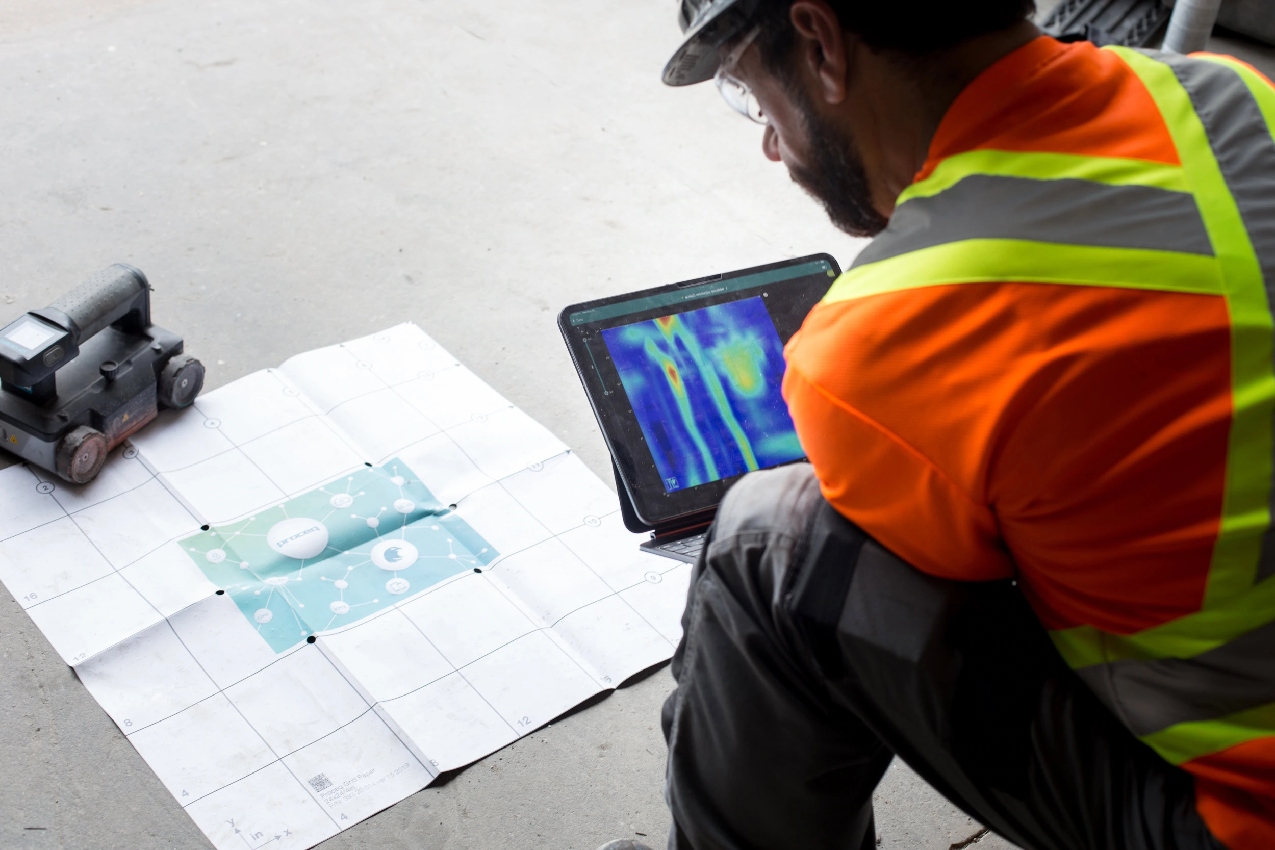
The cart rolls orthogonal passes across the grid. Rebar pops first; PT strands show as deeper, tighter hyperbolae; conduit is flagged by shape and depth.
3. Mark-up
Findings are marked directly on the slab with paint or crayon — depth on one colour, line type on another — so the next trade can work from the concrete, not from paper.
4. Report
Where the project requires documentation, we deliver an annotated PDF with scan screenshots, depths, and locations keyed to site marks.
Utility Locating Above the Slab, Below the Soil
GPR complements — it does not replace — traditional electromagnetic utility locating for buried services. On most projects we pair GPR with electromagnetic utility locating so metallic and non-metallic services are both accounted for.
Serving Hamilton and All of Ontario
From our Hamilton shop at 276 Ferrie St E, crews reach Burlington, Oakville, Mississauga, Toronto, Brampton, Kitchener-Waterloo, Guelph, Cambridge, St. Catharines, Niagara, London, and every point between. For projects in Northern Ontario, Eastern Ontario, or remote sites, we mobilize with self-contained power and water so work does not stall on access.
GPR Scanning FAQ
How deep can GPR see?
In concrete, 12 to 18 inches is reliable; in soil, 3 to 10 feet depending on conditions. Heavily reinforced slabs or wet conditions shorten the effective depth.
Does GPR work on older, cracked concrete?
Yes, with experienced interpretation. Cracks and moisture can clutter the image, which is why operator training matters more than equipment brand.
Can GPR locate plastic pipe?
Yes — that is its advantage over electromagnetic locators, which need a metallic conductor to trace.
Do you provide a written report?
Yes when the scope includes it. Most routine pre-cut scans are marked on the slab only; documented reports cover engineering and insurance scopes.
How quickly can you mobilize for a scan?
Same-day across the GTA and Golden Horseshoe; next-day across most of southern Ontario. Call (905) 529-6029.
Operator Experience vs. Equipment Brand
GPR equipment from the main manufacturers — GSSI, Proceq, Hilti — is all capable. The difference between a useful scan and a wasted mobilization is the operator reading the screen. CDS operators scan concrete every week, across project types from shopping mall slabs to highway bridge decks, and that pattern recognition is what turns raw hyperbolic reflections into an actionable mark on the slab.
Deliverables Beyond the Mark-Up
Most scans end with crayon on concrete. Engineering and insurance scopes need more. We deliver annotated PDF reports with scan images, depth measurements, confidence notes, site photographs, and a methodology statement keyed to ASTM D6432. Where site layout drawings exist, findings are overlaid onto the plan at scale. That documentation satisfies engineers of record and structural reviewers without follow-up requests.
Does dampness really kill the scan?
Moisture attenuates the radar signal and drops depth penetration. Freshly placed concrete, wet slabs, or damp soil all reduce confidence. We reschedule when conditions are poor rather than deliver a scan we cannot stand behind.
Scan before you cut, core, or drill
Concrete Drilling & Sawing Ltd. (CDS) has served Hamilton and all of Ontario since 1967. Licensed, insured, and ready to mobilize on short notice — residential, commercial, and industrial.
Phone: (905) 529-6029 | Toll-Free: 1-800-241-5708
Shop: 276 Ferrie St E, Hamilton, ON L8L 3T7 · View on Google Maps
Service Pages In This Area
This is a hub page — each link below opens a dedicated page covering scope, use cases, and pricing notes for one specific service.
- X-ray-equivalent scanning
- buried-services locating
- our full-scope demolition
- Ontario demolition contractor
- GPR clearance before cuts
Many projects also touch our the cutting-services hub work — scanning, locating, and demolition done by the same crew.
Based in Hamilton, CDS serves projects across Ontario — see our areas we serve across Ontario, including concrete contractor service in London, Windsor and Kitchener.
GPR Scan Reports and NDT Deliverables You Can Act On
On many jobs the most valuable thing we hand over is not the chalk line on the slab — it is the report behind it. Every ground-penetrating radar and non-destructive testing (NDT) scan we run in Hamilton and across Ontario is documented as a clear, as-found record that engineers, project managers and general contractors can act on with confidence, long after our crew has left the site.
A CDS GPR scan report is built to be defensible and easy to read, typically including:
- Annotated scan maps and slab mark-ups locating rebar, post-tension cables, electrical conduit, data lines and embedded utilities
- Depth-of-cover readings and measured slab or deck thickness at each scan location
- Identification of voids, honeycombing and anomalies within the concrete
- 2D and 3D radar imaging where the structure and job scope call for it
- Photo documentation tied to each scanned area, referenced to the building grid or drawings
- A plain-language summary and go/no-go guidance for the proposed cut, core or anchor locations
This is where the reporting saves real money. A documented scan lets crews avoid striking live post-tension cables and buried utilities, prevents the structural damage and injuries a blind cut can cause, and eliminates the delay and re-work of hitting the unknown. It gives engineers a paper trail they can stand behind, and it lets project teams make faster, better-supported go/no-go decisions instead of guessing.
That is why our scan reports are relied on by structural and forensic engineers, project managers, general contractors and facility managers — anyone who has to sign off on what is inside a slab or wall before work begins. Deliverables like these are what turn a scan into a decision, and they inform every safe cut, core and opening that follows.
More reading: concrete scanning articles on the CDS blog.